Vitals
- Locale: Keremeos / Cathedral Provincial Park, British Columbia
- What It's Like: Continuous river running in the hot and sunny Okanagan area of south central BC.
- Class: IV
- Scouting/Portaging: Easy - roadside.
- Level: Online gauge Ashnola River near Keremeos.
- Time: 1-3 hours. Fast laps on the lower 6 km take 30 min.
- When To Go: Early season high water snowmelt in May/June.
- Info From: Many visits.
- Other Beta: None.
- Map: Click here for a map of the river zone.


Description
The Ashnola River is a stream located in the Okanagan region of BC, an area not often associated with whitewater kayaking. Rising across the border in the US, the Ashnola drains Cathedral Provinical Park and flows north to join the Similkameen River near the town of Keremeos. The Ashnola is a unique river with moderate continuous class IV whitewater for miles that appeals to a wide range of boaters. The added bonus is the location in the Okanagan often means hot and sunny weather when the river is running.
There is an accurate online gauge for the Ashnola. The river only flows from snowmelt in the spring and early summer in May and June. In very large snow years it's possible to stretch the season into July. The river has a wide runnable range - 20 cms is low water. The medium flow sweet spot when the river starts to shine is at 35 cms, where it is a really fun continuous class IV section of whitewater. The run is roadside and it tolerates high flows well but the difficulty and issues associated with a very continuous river increase accordingly. Flows of 50+ cms are starting to move beyond the class IV range. There is a stump in the river at the take out camp site that can be used as a visual gauge as well (photo below).
The Ashnola is found a few km west of Keremeos on the Crowsnest Highway (Highway 3). The easiest way to find your way to the whitewater is to follow the signs for Cathedral Provincial Park. Follow the road into the park. There is a great campsite at the 0 km marker (the first point the river is close to the road) where you'll also find the gauge stump. The furthest upstream put in is about 20 km up. You can access the river wherever you like - other popular put in points are at the 12 km and the 6 km markers. There is good camping all along the road up the river.
The general character of the Ashnola is continuous low to medium volume class IV rapids. It is all easily boat scoutable, and the run increases in difficulty as you go further down the river. Groups can start and stop at many locations along the length of the run, made easy by the fact the road is usually right next to the water. For reference, the Ashnola is a notch easier than the Upper Cheak in Whistler. The 20 km to 12 km access is the easiest stretch. Somewhere below the 12 km marker a significant tributary enters and the rapids become more interesting. At the 6 km marker is the largest rapid on the run called Sabertooth - it's easily visible on the shuttle. Excellent class IV rapids continue from here all the way to the take out. Running laps on the bottom 6 km are the best bang for your buck. Smash some laps and then kick back and enjoy the great camping!
 Fantasy Island, located at km 12, is one of the bigger rapids in the upper part of the river.
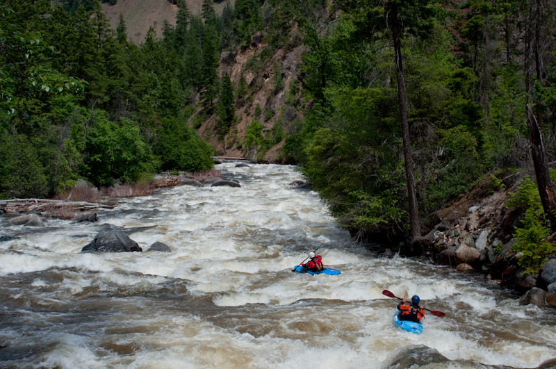
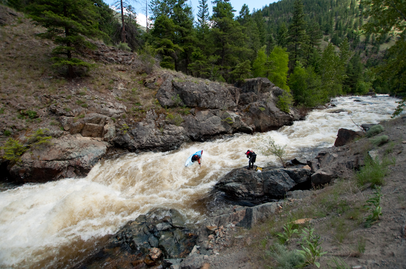 Sabertooth rapid, the biggest one on the river, at the 6 km marker.
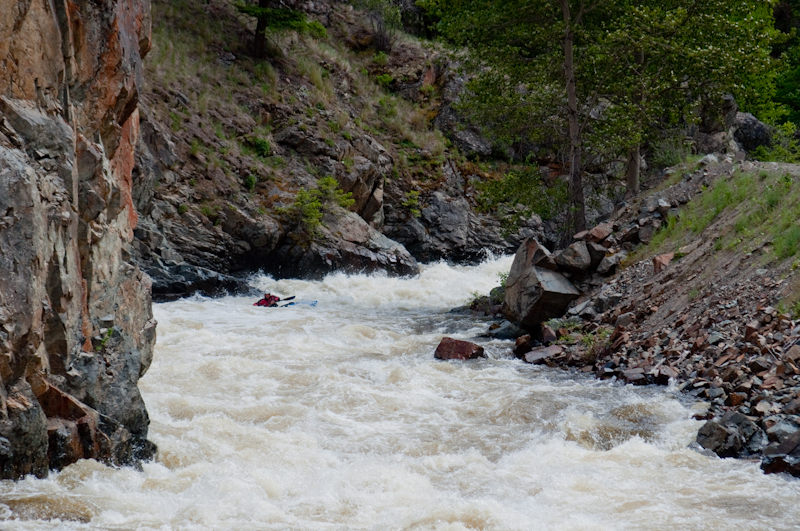 Upstream view looking at the run out of Sabertooth.
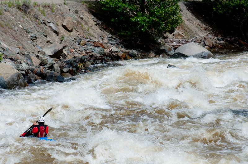 Near the start of the bottom 6 km, approaching one of the best boofs on the run.
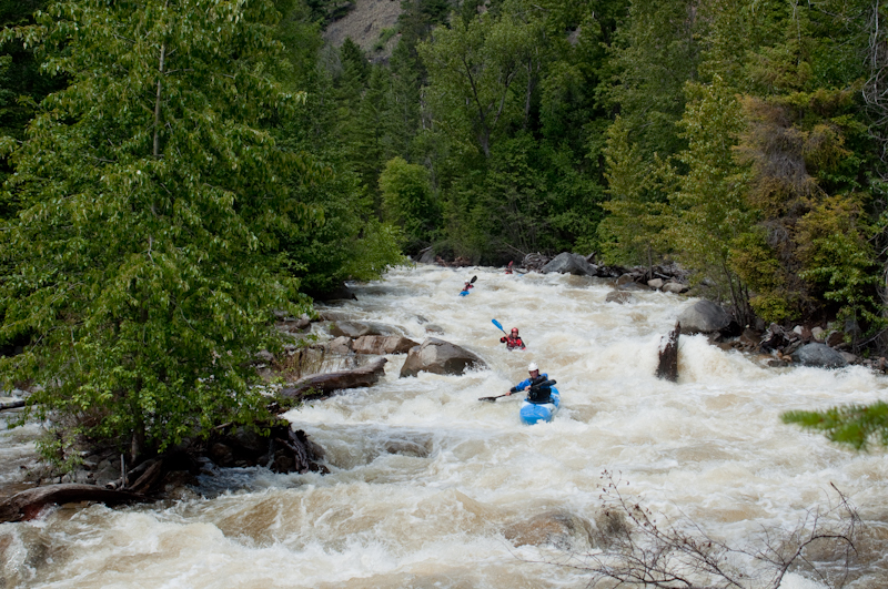
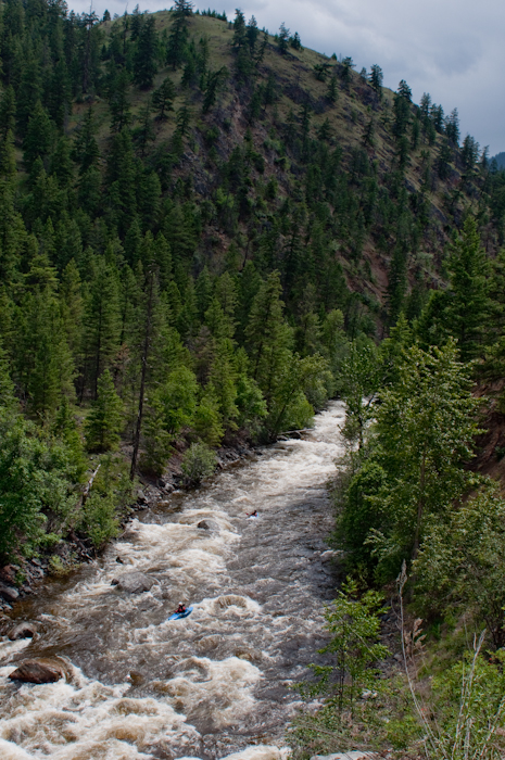
 Typical Ashnola.
 Okanagan scenery.
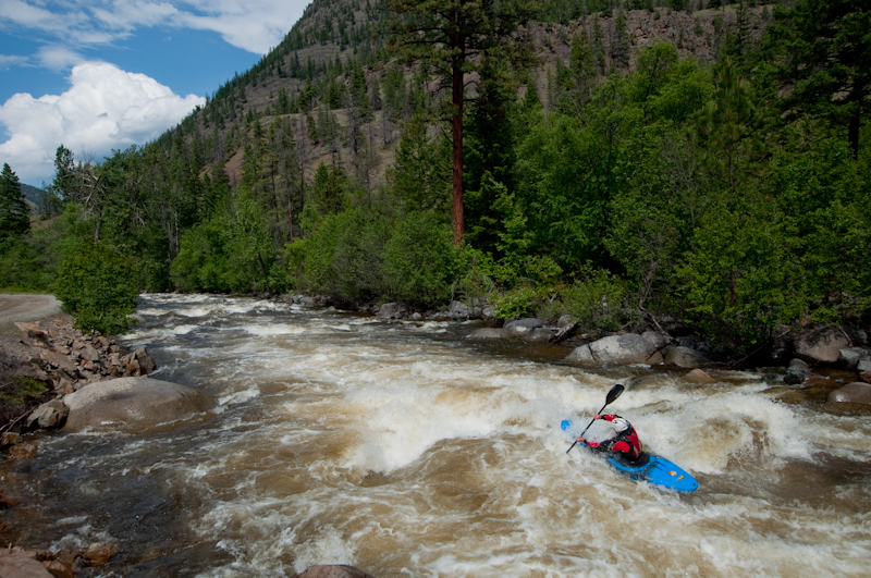 Ashnola boogie.
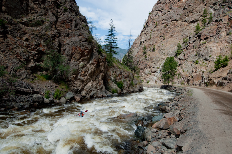 Near the end of the run. The road is that close to the river for most of the run.
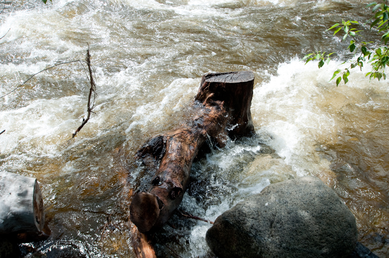 Gauge tree at the take out camp site. This is medium.
Updated May 29, 2017

