Vitals
- Locale: Whistler, British Columbia
- What It's Like: Whistler's ultra classic. Clean waterfalls, bedrock and boulder gardens.
- Class: IV-V at medium levels.
- Scouting/Portaging: Relatively easy, except for portaging the big falls.
- Level: Visual gauge at take out.
- Time: 30 minutes to a few hours.
- When To Go: Reliable season from May through August - runs after rain in the off season.
- Info From: Many visits.
- Other Beta: None.
- Map: Click here for a map of the river zone.


Description
Callaghan Creek is currently under direct threat for hydro development. Please visit the Save the Callaghan Facebook page for the latest info, and to log your use of the creek!
Callaghan Creek is also the site of the annual Callaghan Creek Race, which has been ongoing since 2010.
Callaghan Creek is one of the classic rivers that makes Whistler and southwest BC such a fantastic whitewater kayak destination. It's often the first stop for and is a must do for anyone on a tour of the coast. It's the best after work run for Whistler locals, and people close enough to drive there quickly - once you boof the clean waterfalls you'll know why. Arguably the best whitewater kayak river in a zone that is packed full of classic whitewater, the Callaghan is a river not to be missed.
The Callaghan is runnable at a broad range of flows (making it appropriate for kayakers with a broad skill range), though it does get too high and too low. A staff gauge is present at the take out, just upstream of the rock outcrop most people climb out on in the Cal-Cheak campsite, that makes understanding flows much easier. Generally speaking it is usually runnable for the whole summer, and it is typically on the low side in August. Hot weather will drive the level up high enough to keep all the but gnarliest paddlers off the river, but it's rain in the fall that produces flows that are truly too high to be safe. A level of 0.1 is low, 0.3 is medium and anything over 0.5 is high. If you're still unsure about flows, check with a local.
Part of the popularity of the Callaghan is the ease of access. The take out is just downstream of the highway 99 bridge over the creek. Take the Daisy Lake FSR off of the 99 (follow the signs for Whistler Bungee). Immediately on your right is the Cal-Cheak Campsite - park in the big open parking lot. The put in is accessed on the paved river right road. At the ~4 km mark from highway 99, just past Etna Creek, is a small overgrown road and a muddy/grassy parking area. Walk down the road, take the first left down the obvious, cut trail and head downhill to the river.
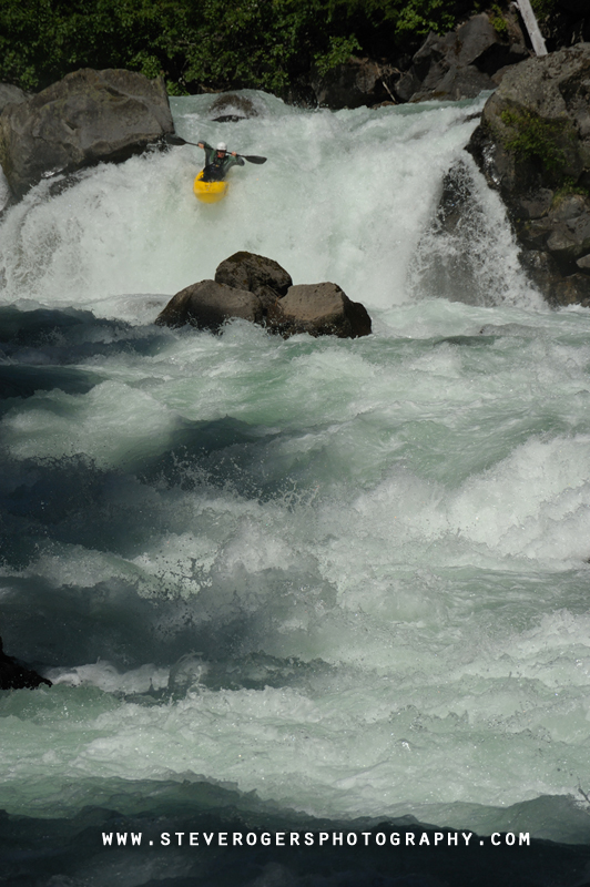
The toughest whitewater on this run is in the first 500 meters. Just below the put in is a big ledge with a bad hole - run it far right - if you can't get far right portaging is recommended. Boulder rapids lead into the waterfalls - you'll find a 12-15 foot falls with the iconic 20 footer shortly after. The rapid in between the falls develops a problematic hole at high water.
Below the waterfalls the river changes to continuous boulder rapids with a few big ones in the mix. At a gradual left bend about 3/4 down the river you will want to eddy out above the Old Dirty Bastard, the biggest non-waterfall rapid. There is often a large log jam on river right above this rapid where you scout. After more boulders and a bit more bedrock you'll all too soon pass under the highway and get to the take out. Hope you have some gas left in the tank because you'll definitely want to run this one again.
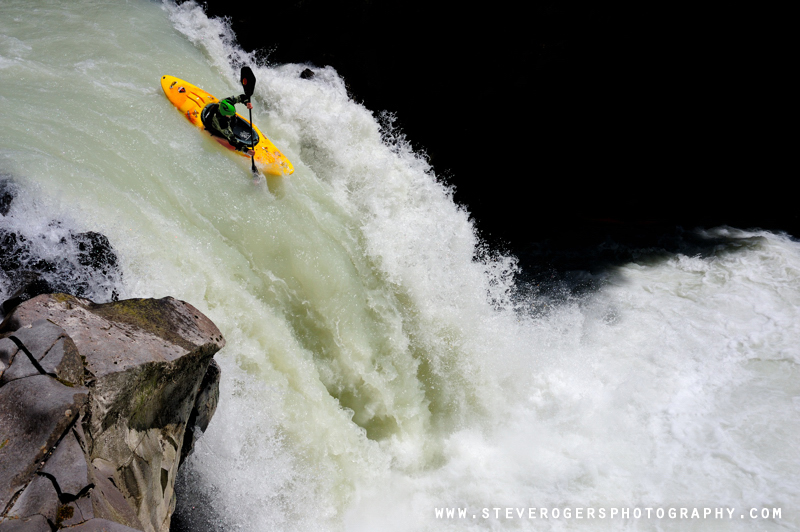
 Flying off the first waterfall.
 The main event.
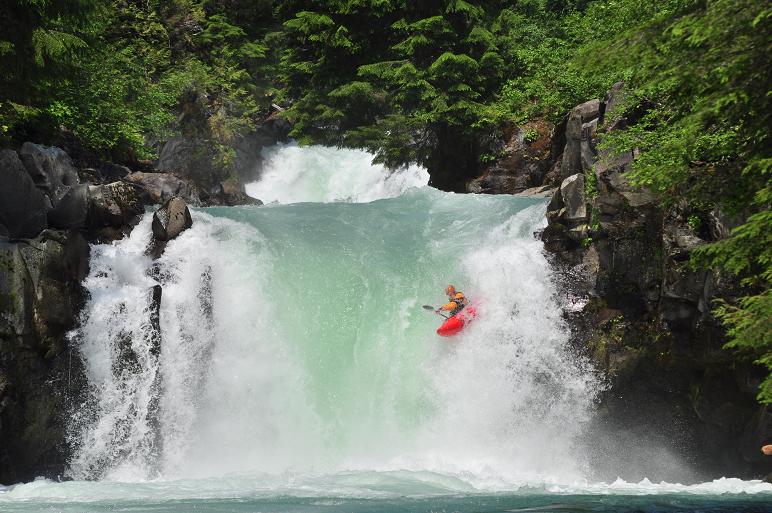 A fantastic place to go kayaking.
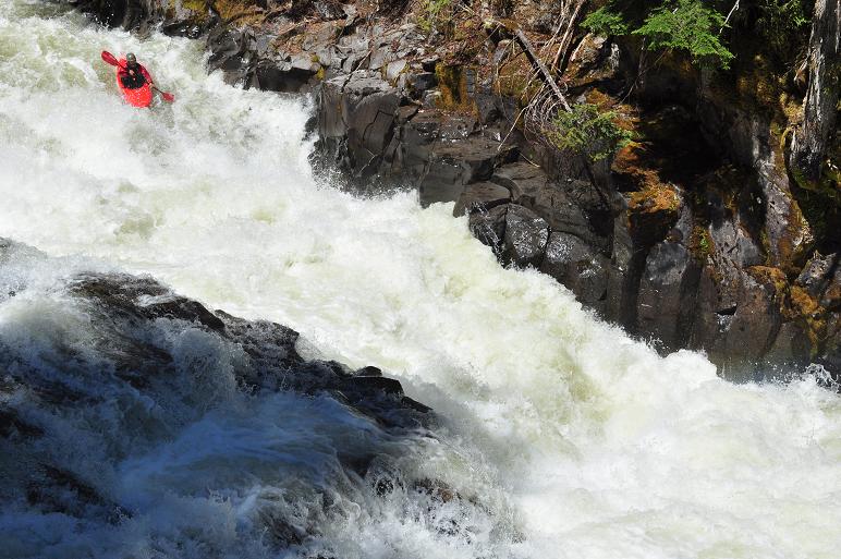 ODB. A burly rapid, but good to go.
Callaghan Creek Trivia
- The original put in was located on river left prior to 2012. A spur road approximately 3.5 km up the river left road was decommissioned, closing access to that side.
- The river right access trail was cut by Philip Middleton in 2013.
- The take out gauge was originally installed in early 2013 by then-local Greg Dashper.
- The gauge was replaced in 2019 by Phil Middleton after it was damaged by flooding. The new gauge was paid for by donations from Callaghan Creek Racers in 2018.
Updated May 8, 2019

