Vitals
- Locale: Chemainus, British Columbia
- What It's Like: Good moderate difficulty whitewater with some beautiful canyons.
- Class: III-IV+ at medium levels.
- Scouting/Portaging: Varies. Some difficult portage options in spots; the hardest rapids have desperate portage options.
- Level: Online gauge: Chemainus River.
- Time: 3 hours.
- When To Go: Winter rainy season.
- Info From: March 2011 at 22 cms.
- Other Beta: None.
- Map: Click here for a map of the river zone.


Description
A large landslide occured on the Chemainus at the start of the second canyon during the winter of 2017. Some rapids were lost. Fortunatley, a flood six months later in the fall cleaned up the landslide debris - the rapids came back, and as a bonus, the former mandatory portage filled in and is now runnable!
The Copper Canyon of the Chemainus is a fun, moderately difficult whitewater run flowing off the southeastern side of Vancouver Island. While much of the river is canyonized and there is great whitewater throughout, the second half of the river boasts the most dramatic scenery and a handful of really high quality rapids, making it a run well worth putting high up on the hit list.
Like many rivers on Vancouver Island, the Chemainus often flows at levels that are much, much too high to consider kayaking during the winter months when the island is pounded by moisture-laden Pacific storms. Appropriate flows are at relatively low levels, so this river can hold water for days as it slowly drops after a big peak. Bare minimum levels are around 16 cms. Normal low is 20 cms. Mid 20's are nice medium levels and 30 cms is starting to get high - the local crowd favour flows in the high 20's. At 35 cms the crux rapids are class V. It's doable higher, just keep in mind it's quite difficult to walk the biggest rapids at the end of the run.
The Copper Canyon is located about half way between Duncan and Ladysmith and it has a lengthy shuttle. To reach the take out look for Mt. Sicker Road off of Highway 1. Follow the road to a T-intersection and go right onto Cranko Road. At the "end of public road" sign turn left and drive down the dirt road until you are underneath a transmission line. This is the take out parking - a gated road goes down to the water.
To reach the put in, head back south on Highway 1 and then west towards Lake Cowichan on Highway 18. After about 8 km turn right onto Hillcrest/Hill 60 road and follow it along the obvious main branch until you can see the river close to the road on the left. At this point you will be in the unassuming Chemainus River Park where there are some parking spaces and trails down to the water. There is also intermittent access on river left, which is much shorter.
Copper Canyon starts out as splashy class II. There is one notable rapid before the first canyon. The first canyon is straightforward, with one challenging rapid called Powerhouse. The scenery is particularly impressive. After an obvious break, the second canyon starts where a 300 foot tall wall appears on the right. As you paddle directly underneath the wall eddy out on the right for an easy portage around a nasty slot (runnable as of late 2017). The section below here is the best and most challenging section on the river. Come prepared to run this part as portage options are difficult. After the rapids subside take out on river right where the powerline/gas pipe crosses the river and walk up the short hill to where you parked. If you are fired up you can even hike up to run the falls that comes in on river left at the take out if the great whitewater upstream didn't satisfy your appetite.
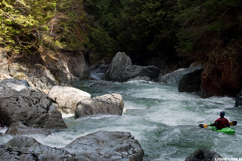 The lead in to one of the first notable rapids called Powerhouse.
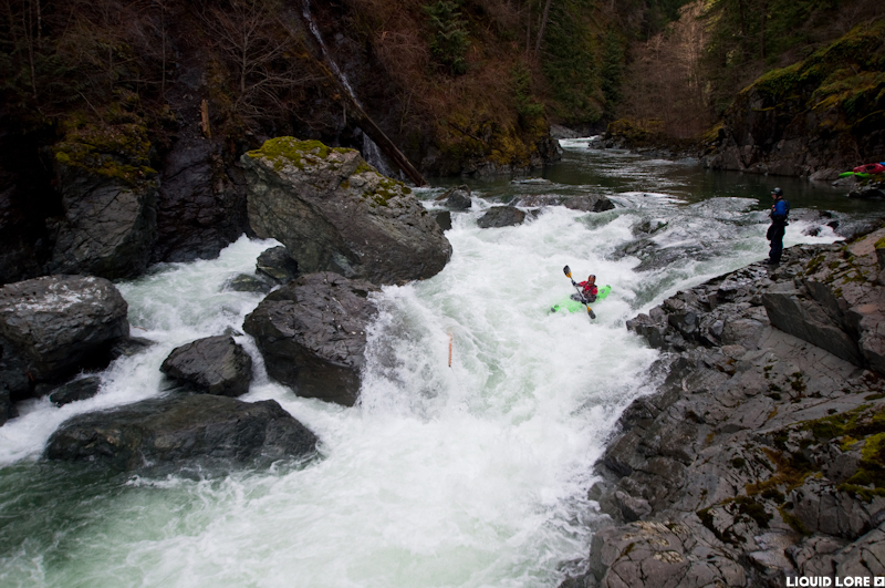 Random slide. There is currently a terrible gaping sieve on the right side of this rapid. This rapid disappeared in the 2017 landslide.
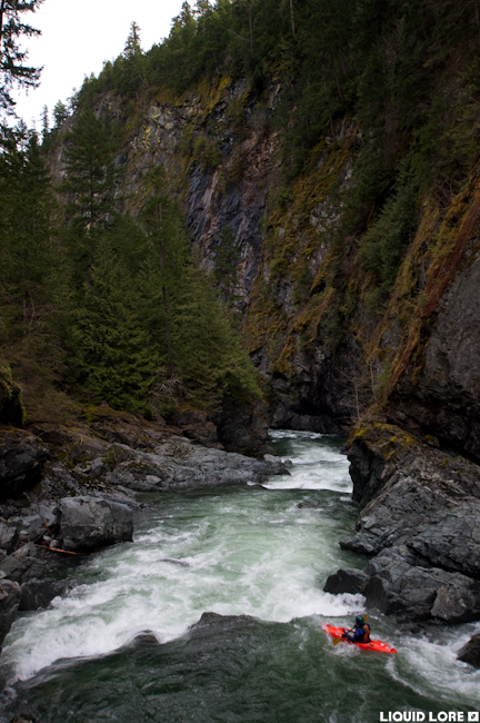 The massive river right wall at the start of the second canyon.
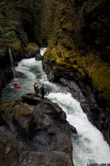 In the heart of the second canyon.
Updated Feb 13, 2018

