Vitals
- Locale: Stein Valley Nlaka'pamux Heritage Park, British Columbia
- What It's Like: Remote, multiday, hike in, hard core creeking. Includes a pleasant paddle out on the main Stein.
- Class: V+
- Scouting/Portaging: Moderate. Portaging in the steep section is easy compared to the approach.
- Level: Visual only. Possible correlation to the Nahatlatch - look for it to be medium.
- Time: 4-5 days, including the main Stein.
- When To Go: July-August, depending on the snowpack.
- Info From: August 2012.
- Other Beta: Liquid Journal by Mark Basso.
- Map: Click here for a detailed map of the river zone.


Description
The North Stein. The dirt bag route to access the main branch of the Stein. It could be the stoutest, steepest runnable mile of whitewater in the whole southwest BC/Coast Mountain zone. The North Stein was first discovered in the early 2000's by a team of local rippers, with the first descent happening in 2003. What was discovered was a short section of very steep and almost completely runnable gnar with difficult hike-in access. As an added bonus, running the North Stein leaves you just a few km downstream of Stein Lake on the main Stein, the start of one of the classic fly-in multiday runs in the area, leaving you with another 50 km of fun whitewater to paddle. This is a strenuous trip with huge whitewater that is far, far away from any roads. If you're not ready to go big way out in the wilderness and you still want to do the trip, it's an acceptable but challenging way to access the main Stein.
There is no gauge for either the North Stein or the Stein River, and it's basically impossible to get a visual level without hiking in to the creek. As such, one of the biggest challenges for a trip here is getting the flow right. While it should tolerate some variation in flows while remaining runnable it will definitely get too high and too low. In most years the best betting time should be in late July and early August, depending on the snowpack. This trip happened when the Stein was at a solid medium level, and when the Nahatlatch (as reported by REO Rafting) was running at approximately 2.2 on their gauge (also medium).
Take out access is the same as that for a trip down the main Stein. Park a car somewhere with public access to the Fraser River in or near Lytton. Accessing the river requires a lengthy drive and a long hike over difficult terrain with no trail. The 'trailhead' is located in the Van Horlick Creek valley; Van Horlick Creek flows in to the west end of Duffy Lake. From the Duffy Lake Road, the road up Van Horlick on river right is slightly overgrown, but it is in good enough shape to drive up in a 2wd with some clearance. When the road forks at about the 9 km mark, take the left branch. After another 2 km you will reach a second fork. This is essentially the end of the road as the left fork is overgrown to the point of not being passable, and the right fork is deactivated, with a bridge removed just 100 m from the fork. Unless you have a serious 4x4, this is the current trailhead.
Without a GPS, or even a map, the hike in is relatively straightforward. You can almost see the pass between Van Horlick and the North Stein drainage from the start of the hike. Our team decided to hike up the river left (not overgrown) road until it ended. From there you can descend a clear cut to the valley bottom where it is relatively easy going (considering there is no trail and you'll be carrying a kayak) to hike towards the pass. There is a prominent moraine at the head of the valley - climb the moraine towards the pass. Once the forest thins it's easier to walk in the open meadows, though the end of the moraine is only about half of the elevation gain. Upon gaining the pass you'll cross in to an open alpine valley and you'll be moving fast. Perhaps the worst part of the hike is the final 1 km descent (300 m elevation loss) down to the North Stein. At a moderate pace this hike takes about 8 hours.
The North Stein when you reach it is a very small creek, and it is absolutely infested with logs. It should take 2-4 hours to paddle the 10 km to the start of the good whitewater. It is tedious low volume 'paddling' with many, many portages around wood. The volume picks up as you get further along the river, and with the increasing volume the logs become less of a problem. There isn't a lot of good camping along the upper North Stein. If you want to have the best success in running the steep section of the river, you should arrange your schedule to spend a night as close to the steepness as you can. With an early start on the first day, most groups can reasonably complete the hike and a large portion of the paddle approach in 1 day, the hard section of the North Stein can be done in a day, and the main Stein will take 2 days for a total of 4 days. You could also take the relaxed route and do the hike/paddle in over 2 days instead of 1.
The goods on the North Stein start when you reach a slide. There's not much point in describing the whitewater. For how steep this run is, it's relatively easy to scout and portage. Take your time, run what you can and enjoy checking out this unique run. You'll find slides, stacked drops, rapids, wood, some mank and three really big drops/drop combos that will test even the best. There is a short run out between the last big rapids and the confluence with the main Stein. Check out this link for beta on the main Stein multiday. Groups coming off the North Stein can easily complete the Stein in 2 days - we recommend camping just below the cable car found a few km below the confluence on your first night on the Stein, and after the log jam portages in the flat water on your second night on the Stein. The trip ends on a high note with 15 km of awesome read and run whitewater between the flat water and the confluence of the Stein and the Fraser.
Unfortunately LiquidLore doesn't have a lot of pictures of this run. In the absence of photos, check out the map of the area, and an excellent video of the North Stein from the 2011 season put together by Adrian Kiernan at White Box Magazine.
View North Stein in a larger map
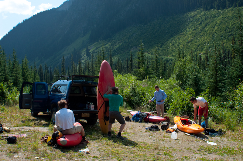 Getting ready to hike at the end of the road - at least the end of the reasonable bit of road.
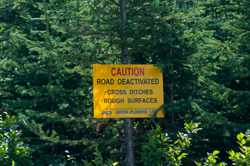 The sign indicating the main road is activated - not that it isn't obvious.
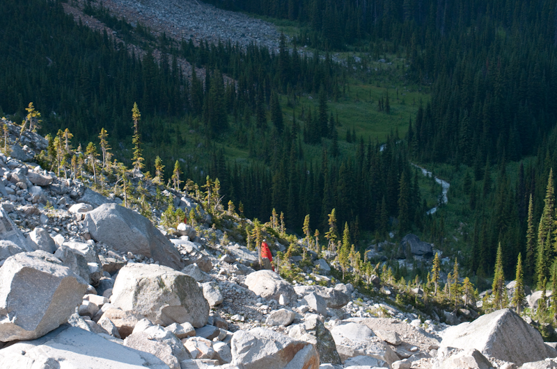 Battling up the steep moraine headed for the pass.
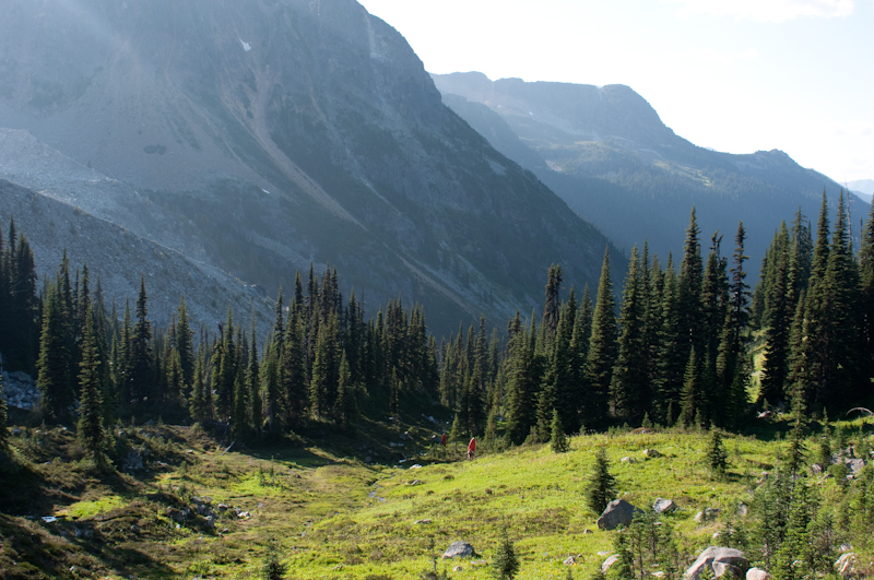 Fighting to the end - beautiful wide open alpine scenery.
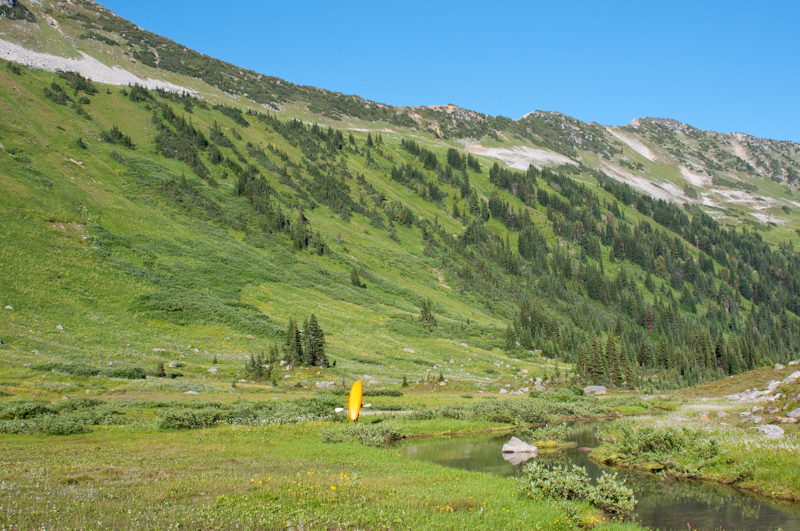 Cruising the alpine valley once you drop in to the North Stein drainage.
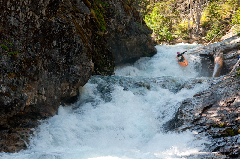 One of the first really good rapids in the steep section of the North Stein. This is the last photo we have. This is one of the smallest rapids on the run - enjoy, and be ready to fire up some big stuff.
North Stein Trivia
- The North Stein was first descended by a team of Germans using prototype fiberglass Prijons in 1982.
- The second descent was by Corey Boux, Dave Norell and Braden Fandrich in 2003.
Updated August 29, 2012

