Vitals
- Locale: North Vancouver, British Columbia
- What It's Like: Classic kayaking in a deep box canyon. You would never know it's in the heart of North Van.
- Class: Highly level dependent - ranges from fun class IV to raging class V.
- Scouting/Portaging: Moderate scouting, difficult to impossible portaging.
- Level: Online gauge. There is also a visual gauge at Mt Seymour Parkway.
- Time: 1.5 hours including the hike for a first run.
- When To Go: Rain-fed all year, snowmelt in the spring and summer.
- Info From: Many visits.
- Other Beta: None.
- Map: Click here for a map of the river zone.


Description
On December 7, 2014, a large rockslide occurred in the Seymour Canyon at the rapid known as Mosh Pit. This catastrophic event dumped 50,000 cubic meters of rock in the river, creating a large pile of boulder debris that dammed the river to form a lake that extends far above the Twin Bridges put in, drowning the first three rapids in 30+ feet of water. The cataract formed by the debris is currently unrunnable. The impact on kayaking is significant and irreversible. This event had similar significant impacts on hiking and mountain biking trails, and as the Twin Bridge at the historic Canyon put in was removed, a critical river crossing in the Lower Seymour Conversation Reserve trail system was lost. Efforts to blow up the landslide are ongoing (to save the salmon of course) - it remains to be seen whether it will eventually become runnable again. This blasting is currently having a negative impact on kayak navigaiton. The first rapid cycles between runnable and unrunnable as jagged blast rock slowly trickles down river during high flow events.
The Seymour Canyon is a classic local run. And local it is - this river literally runs through the middle of North Vancouver. It's also short - so much so that you can drive to the trailhead (it's a hike to the top), get geared up, hike up, paddle and drive home in less than an hour and a half - kind of like going to the gym, but better. The whitewater on the Seymour is great stuff - not too steep, pool-drop and in an impressive canyon that is as beautiful and intimidating as any other in the area. Although the 2014 landslide shortened the length of the run, it is still worth the effort as the majority of the rapids remain unchanged.
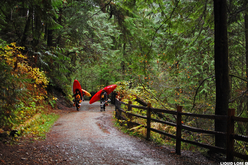
Seymour access is easy. While there is a road to the put in, it is much faster to just walk up the well maintained trail from the take out. Go to Riverside Drive in North Vancouver and drive to the north end of the road - it is a dead end. About 100 meters before the end of the road is a gate and a big set of stairs down to the river - park near here as this is where you'll come up from the water. From May through October you'll need a permit to park anywhere around here, and also during that time the gate at the top of the stairs is locked. There is an alternative take out about 500 meters back down Riverside at the end of Swinburne Avenue. The hike to the top takes around 20 minutes - follow the obvious river left trail at the end of the road. The put in is below the landslide site down an obvious gully. Access to the new lake is closed indefinitely.
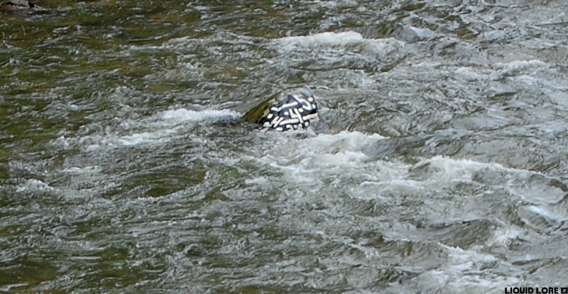
One of the great things about the Seymour is that it is accessible at a wide range of water levels. There is a convenient painted rock gauge upstream of the Mt. Seymour Parkway bridge that is most commonly used for a visual level. Precise levels on the rock are open to interpretation. There is also an online gauge, but the flow updates are often a few hours behind the current time, and there is variation depending on the time of year and whether the river is rising or falling.
Low water is about 2 on the rock. It can be run lower but it sucks. Medium water is 3 on the rock, and anything over 4.5 on the rock is high. At 2 the Seymour is a low stress, low volume class III-IV run. Jack to level up to 3 and you're looking at mainly class IV whitewater with a walkable IV+ rapid at the end. When the gauge reads 5 (just spilling over the top of the rock) this river is a serious class V section of whitewater with few eddies and very pushy lines. You'll need to go run it yourself to find your upper comfort level. Online flows of 15 to 45 cms roughly correlate to 2.5 to 5 on the rock. The online gauge tends to read low in the winter.
The Seymour used to start with a short section of wide, bouldery whitewater before you got to the entrance of the canyon. There were two small rapids (a flume and a boof) then the first major rapid called Mosh Pit. These rapids are gone, replaced by a lake and a huge sieve-filled cataract. The kayaking now starts below the rockslide where you essentially launch directly into the first rapid called Boney Drop. A series of class IV rapids lead to the two big rapids called Triple Drop and Final Exam. Final Exam is the crux rapid of the run at all reasonable levels and it can be semi-portaged on the left if the level is below 4. It is easily scouted from the trail at the pipeline bridge on the hike in. Once the canyon walls fall away, take out at the rock outcrop and hike the 130+ stairs back up to your car.
 The gauge rock upstream of Mt. Seymour Pky. A nice level of 3.5.
 Pleasant hiking to the top.
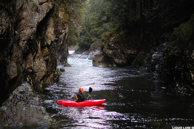
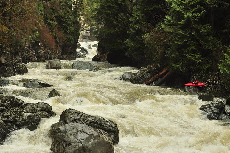 Launching in at the new access point with the rockslide rapid in the background.
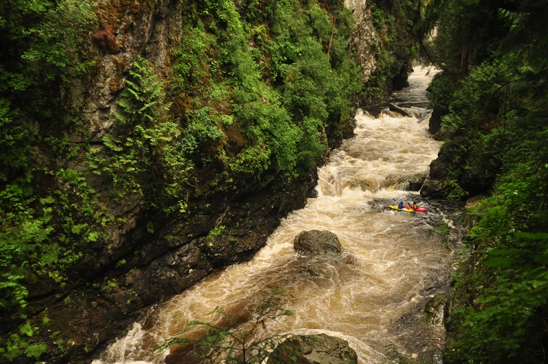
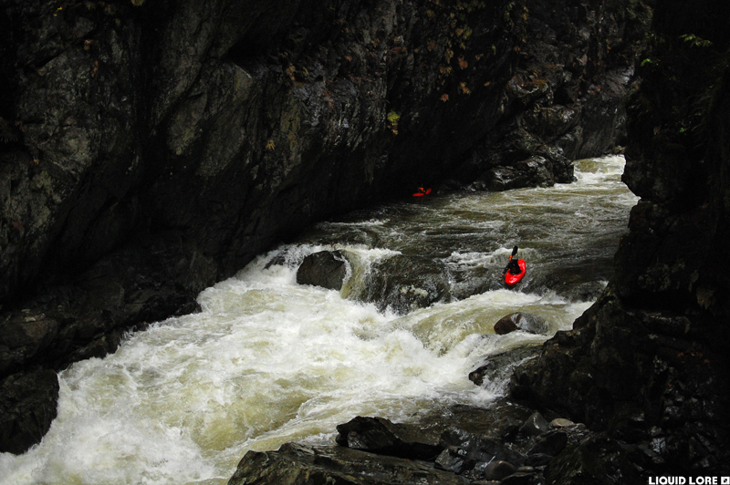
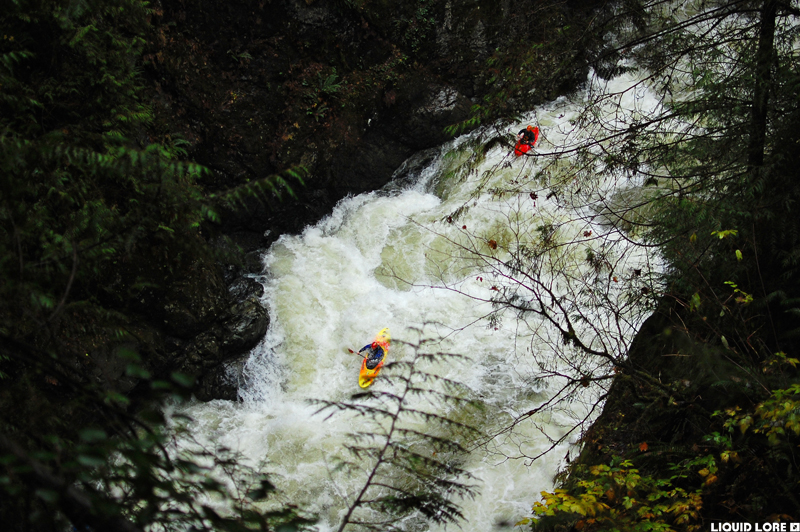
 Some of the early rapids - it's a big canyon.
 Taking it all in during a rare juicy mid summer flow window.
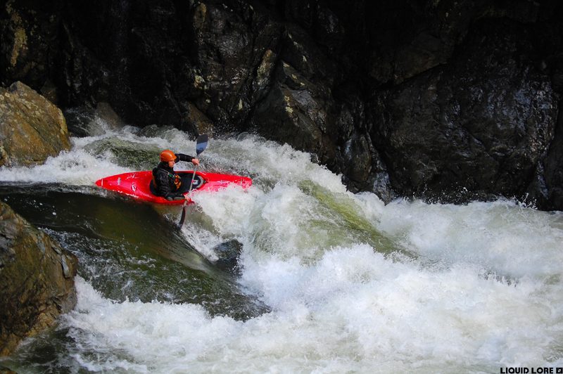
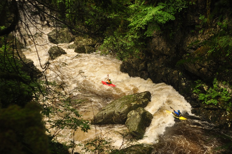 A dynamic pillow move, most fun at higher flows.
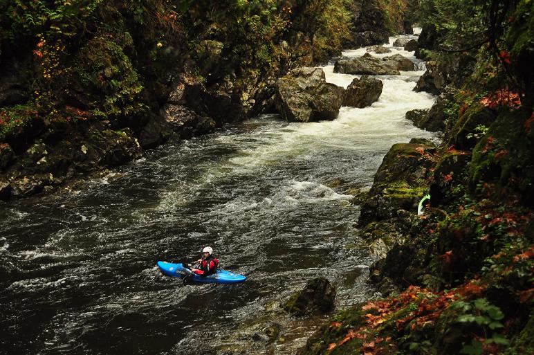 The calm stretch above Triple Drop.
 Triple Drop at 3.5.
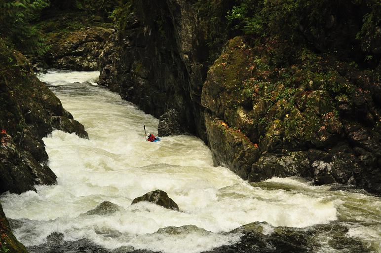
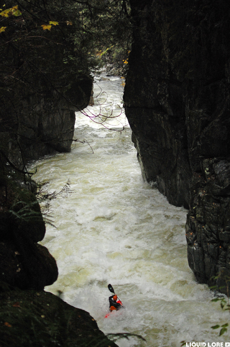
 The tricky entrance to Final Exam.
 Final Exam from high on river right.
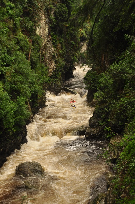
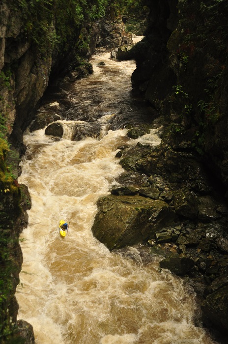
 The exit of Seymour Canyon at high water.
Historical Seymour Photos
 This was the pool that existed above Mosh Pit prior to the landslide. Mosh Pit was the first of the three big rapids in the original Seymour Canyon run. Upstream are the two warmup rapids, which are now submerged under 30+ feet of water. This photo was taken from the approximate location of the landslide.
 This was the entrance move to Mosh Pit. This rapid changed over the years as pieces of rock fell from the right wall. The catastrophic change from the landslide in 2014 was exponentially bigger than any other rockfall seen before.
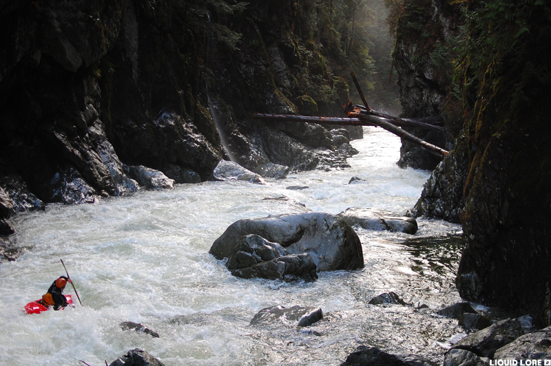 A downstream view of Mosh Pit. The bedrock pinch at the bottom of this rapid remains identifiable as none of the large boulders from the landslide made it that far down river. The two rapids after Mosh Pit changed as well due to smaller debris from the landslide flushing downstream. The logs spanning the river in this photo appeared during a flood in early 2010, and washed away during a flood in October 2014.
 A view of the bottom half of Most Pit from high on river left. This viewpoint is still there - it's a good spot to look at the landslide and the new rapid.
Seymour Canyon Trivia
- The last descent (unknowingly at the time) of the Seymour Canyon's upper rapids that were erased by the landslide was by Steve Arns and Will Riorden on Dec 6, 2014.
- A staff gauge was located at the old Twin Bridge put in before the rockslide. The normal runnable flows ranged between 0.7 and 1.4 meters.
Updated November 23, 2016

