Vitals
- Locale: Harrison Lake, British Columbia
- What It's Like: Boulder rapids in deep gorges, one clean waterfall. Fantastic scenery.
- Class: IV-IV+ at medium levels
- Scouting/Portaging: Easy to moderate.
- Level: Visual. Possible correlation to the Nahatlatch.
- Time: 2-4 hours.
- When To Go: Early/mid season run - May through July. Will get too high at peak snowmelt and too low in mid/late summer.
- Info From: Several visits.
- Other Beta: The Range Life, Gorged Out.
- Map: Click here for a map of the river zone.


Description
The section of Big Silver Creek (Middle Big Silver) below the Upper has been lost to hydro development as of 2016, however this section should be minimally impacted. A tributary of Big Silver Creek (Shovel Creek) above the Upper is also under direct threat, but the project is currently on hold.
Upper Big Silver Creek is a fun section of whitewater hidden away deep in the southern Coast Mountains, flowing directly into Harrison Lake. While it's out of the way from pretty much anything, and there are limited other paddling options close by, it is a worthwhile destination as the area is beautiful and the moderate paddling combined with deep box canyons and clear green water makes for satisfying and aesthetically pleasing kayaking. This is a great river for people wanting to get down in some big canyons without the stress of having to paddle hard class V whitewater to get there.
Big Silver is accessed from the Fraser Valley east of Vancouver. Go to Harrison Hot Springs and take the Harrison East FSR up the east side of Harrison Lake. The kilometers are well marked the whole way. When you reach Big Silver Creek, the Harrison East FSR will begin to head up the Big Silver valley. The put in is just shy of the 57 km marker where there is an almost roadside 30 foot waterfall. You have to bushwhack up to the road to take out between the 52 and 53 km markers because of a reportedly unrunnable canyon below. Scout your takeout carefully as if you drop much below here the walk out gets much longer. The access and shuttle is a long drive on a dirt road that is rough but not overgrown - much of it is in good shape because of the hydro project just downstream of the take out.
There is no online gauge for Big Silver and the level is visual. Unfortunately it is difficult to see much of the notable whitewater from the road, but as you drive up you should be able to get a feel for flow based on eyeballing the river at the spots it's visible, even if they are not part of the Upper. Big Silver does run after rain (sometimes year round, though most years the upper will be snowed in during winter), and a normal snowpack snowmelt season is mid May through late July, or early August in better years. It is not glacier fed and it pretty much dries up when the snow runs out. The Nahatlatch online gauge is probably the best correlation to Big Silver. Preliminary data during snowmelt: 50 cms was a medium low flow, 70 cms was medium/medium-high.
The put in waterfall of Big Silver is optional. It is an intimidating waterfall as 1/3 of the flow pours into an enormous sieve that is just a foot or two from the line, but it is otherwise a clean pool-to-pool 30 footer. Upper Big Silver is divided into two separate canyons separated by a distinct section of open class II. The first canyon starts around the corner from the waterfall. The character of the river stays the same through its length with boulder jumble pool drop rapids in the canyon bottom with reasonable scouting opportunities, making just putting on a dealing a viable approach. Half way through the second canyon a tributary (Gold Creek) enters and substantially increases the flow, making the last few rapids some of the best on the river. Once you pass through the long straight box canyon and the walls fade away, paddle a few hundred yards and get ready for a 15-20 minute bushwhack back up to the road.
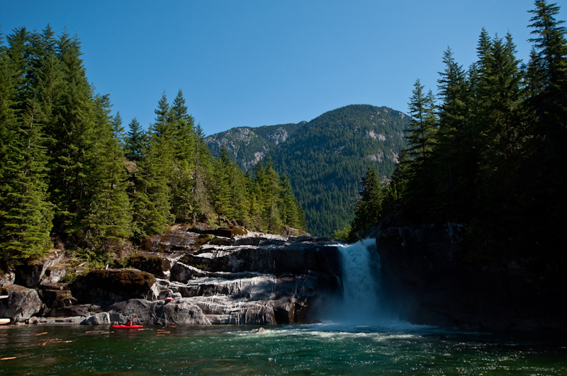 The put in waterfall - flat pool to flat pool. You can see a log stuck in the sieve at the lip in this photo. This drop is intimidating because of the sieve, but for a 30 foot drop it's otherwise straightforward.
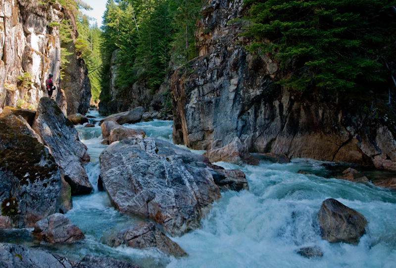 Scouting the most challenging section of the first canyon.
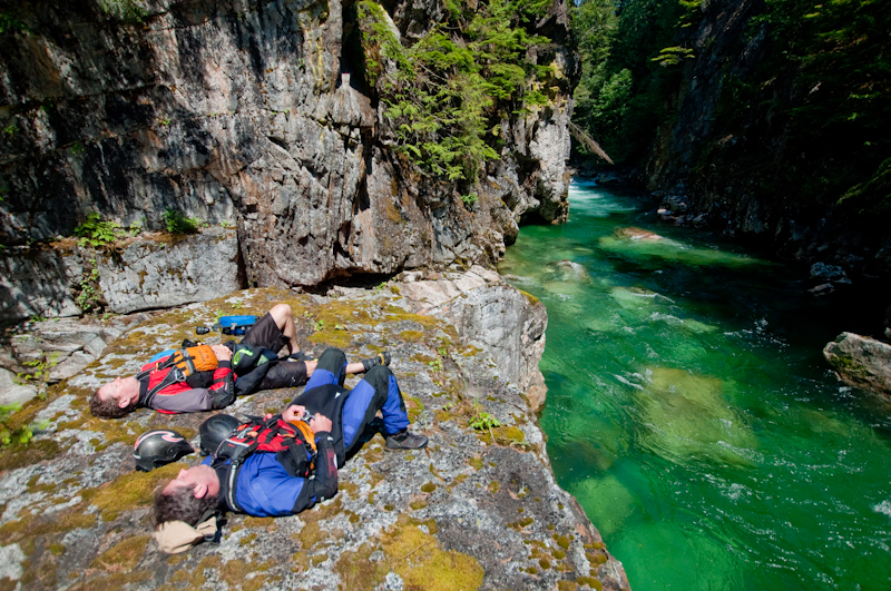 Lunch stop just below the Gold Creek confluence.
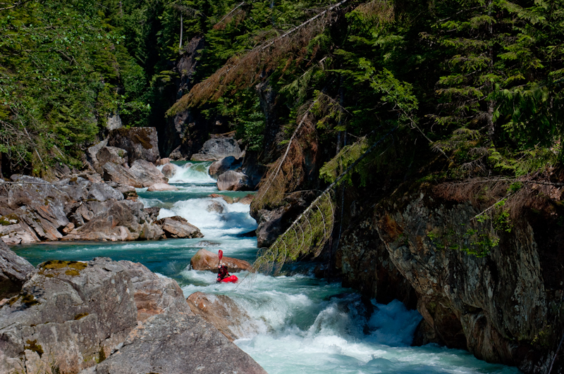 The best section of upper Big Silver - a short stacked hallway below Gold Creek.
Updated July 24, 2014

