Vitals
- Locale: Jacques-Cartier Provincial Park
- What It's Like: Short, steep and roadside. Good quality.
- Class: III-V continuous at medium flow
- Scouting/Portaging: Easy.
- Level: Visual gauge at put in.
- Time: 1-2 hours for your first trip without a guide.
- When To Go: Spring snowmelt in April/May, or after rain.
- Info From: Many visits.
- Other Beta: None.
- Map: Click here for a map of the river zone.


Description
This page was last updated in November 2008 and it is not regularly maintained. Information may be inaccurate.
The Lower Cachee River - or Basse Cachee in French - is located north of Quebec City in the semi-mountainous region between Quebec City and Lac St. Jean. The Cachee meanders through the highlands above the impressive Jacques-Cartier valley, suddenly draining steeply down to the Jacques-Cartier River. The Cachee is a great compliment to the other whitewater in the area, offering a short section of steep boulder rapids and quality bedrock drops where the majority of the other runs around there are sizable rivers with long shuttles.
Getting there is easy. Simply drive north from Quebec City on highway 73, which becomes highway 175 as it shrinks down to a 2 lane highway. A few kilometers past the change comes a Petro Canada/McDonalds service station. About 5 or 10 minutes past here, on the west side of the highway, is an obvious gate into the Jacques Cartier Park (you have to pay to enter, and sign a waiver to go kayaking - it's important you do this). Just past the gatehouse is the put in parking lot. The river flows west away from the parking lot - it is obvious where to start your day. If you're so inclined you can scout the whole run by bushwhacking through the woods along the river. To get to the takeout, keep driving along the road that goes (very noticeably) down along the river. After 2 km a bridge will cross the river just before it dumps into the Jacques Cartier - this is the takeout.
The water level on this run flashes up and down very quickly. For example, it's not uncommon for the level to change by several inches at the put in gauge during a run down, especially after rain. The put in gauge is located in the flatwater at the start of the run - look for a big rock with lines painted on it, as shown in the picture below. It's good to go at a lot of levels, including much higher than in the picture. A good indicator if you'll have fun is to check the first notable rapid - if it looks ok for you, the rest will be fine. The upper Cachee is an alternative if the lower is too high, though it isn't nearly as good.
On the water, flatwater quickly subsides after the gauge rock and the river drops through 100m of straightforward whitewater. When you see a narrowing and steepening of the river, get out on the left to scout. The first three or four rapids are the hardest on the run. You'll first encounter a long rapid with a hole, a 20 foot cascade and a nice section of ledges. After a bedrock double drop beware the next boulder rapid which has a deceptively sticky hole at the bottom - it causes many swims.
The second half of the run is a section of class III-IV boogie and some bedrock slides. After the slides you'll soon reach the take out. If you find yourself around Quebec City during the spring, or when it's raining, this creek is definitely worth the effort. Although it's short, it has a lot of excellent rapids in a short distance and it's really easy to run laps. Keep an eye on the weather and snowmelt, and go when you get the chance!
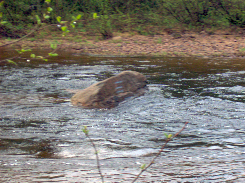 The gauge rock. This is medium-low. It can be done lower. It has been done at least as high as the top of the rock.
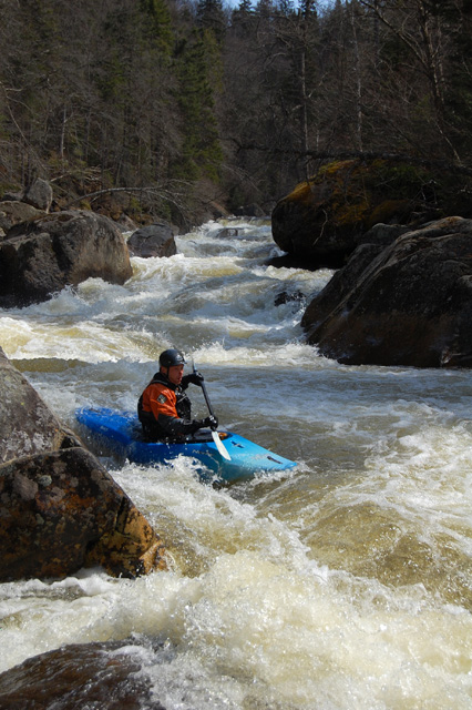
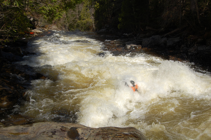 Taking a big piece of meat in the first rapid. The horizion for the cascade is in the background.
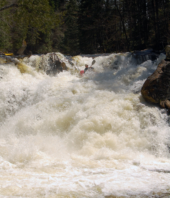 The cascade. Multiple options.
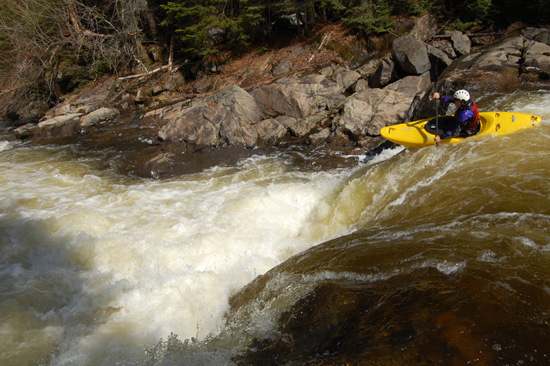 Good ledges below the big drop.
 Boulder rapids.
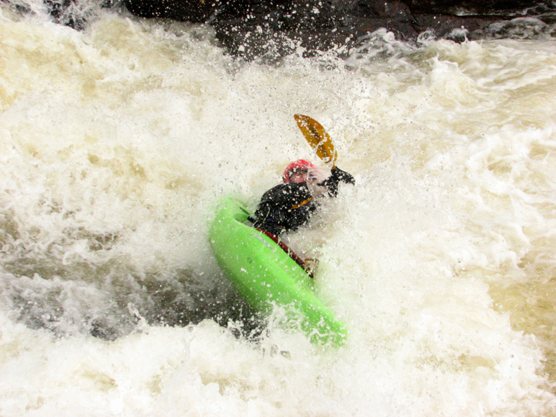 Taking a beating in the sticky hole.
Updated Nov 24, 2008

