Vitals
- Locale: Parc Jacques Cartier, Quebec
- What It's Like: The Taureau's big brother - big gorges and big rapids in the wilderness.
- Class: V (V+)
- Scouting/Portaging: Difficult and strenuous.
- Level: Online gauge: Riviere Jacques Cartier. Divide by 3 to get the Taureau flow, which correlates to the JCNO.
- Time: Ideally 2 days. 1 day if you charge hard.
- When To Go: June, at the tail end of snowmelt.
- Info From: May 2008.
- Other Beta: None.
- Map: Click here for a map of the area. It has some invaluable information. Zoom in for high resolution.


Description
This page was last updated in May 2009 and it is not regularly maintained. Information may be inaccurate.
The Jacques Cartier River in Quebec is one of the most recognized in the province, and it contains many sections of cool whitewater. Perhaps the most revered of these is the Taureau section in the upper reaches of the valley - it's a remote one day wilderness run full of fantastic whitewater. One of the best parts of the run is the paddle out through the Jacques Cartier gorge - an ancient cleft in the ground with towering walls on either side, blanketed with thick boreal forest. As the last of the whitewater on the Taureau all but disappears, a tributary of equal size enters from the right, obviously running through a huge canyon upstream of the confluence - this is the Jacques Cartier Nord Ouest.
The JCNO can best be described as the big brother of the Taureau. It has a monumental shuttle. There is a huge portage around a gorge that few, if anybody will ever run. The whitewater on our trip was hard class V the whole way, and portaging at river level is difficult. Do this trip for the adventure - it's a good one. Our trip through the JCNW gorge goes down as one of the most memorable kayaking trips I've taken and if you spend any time in that area at all, it will be worth the effort to get in there some day. This beta is based on a high water trip in May 2008. Level recommendations may not be accurate.
The JCNO actually has a bigger river bed than the Taureau section of the Jacques Cartier. The Taureau gauge is notoriously inaccurate (it's far downstream with many tributaries between the upper reaches and the gauge), and there are multiple arcane tricks to try and interpret how the reading correlates to actual flows in the river depending on the time of year, local rainfall and the phase of the moon. Lacking a lot of hard data, I would suggest that somewhere between 40-60 on the gauge would be a good flow range - this would typically mean high water on the Taureau. We did our trip at about 90 cms in mid May - it was too high, at least for us.
The shuttle on this river is not trivial. There is the option to drive to the put in, but it would be a long drive on roads where maps aren't readily available. To access the top of the river the quick way, it is possible to fly out of St. Raymond with Aviation Mauricie to the lake on the northern branch of the river above the gorges. See the map linked above to get a feel where this lake is located. The take out easy to find, being the same one as that of the Taureau. It is located at the northern end of the road along the river in the Jacques Cartier Park.
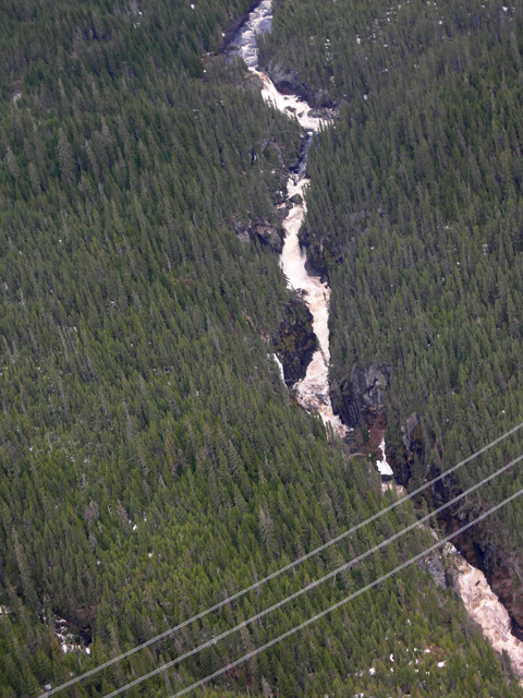
The countryside here is very wild and scenic with tannin stained water and dense forest. Out of the lake you'll find flat water with current, and some easy whitewater. Eventually another branch of the river (coming from the southern lake, which is also a possible landing destination) joins up, the volume jumps and you'll encounter some better rapids. There is only one big rapid in the section upstream of the JCNW canyon - it is a small waterfall with an undercut at the bottom that did not go at high water.
When you get to a bridge, get out of the river. Downstream is the start of the JCNO canyon. Just around the corner the river drops into a major gorge containing a few big waterfalls, lots of big rapids and limited river level portage options. It is critical to scout this beforehand if you have aspirations to run it. It will need quite low water for it to even be possible - it's likely the rest of the run will be too low when this initial gorge is runnable, if it is at all.
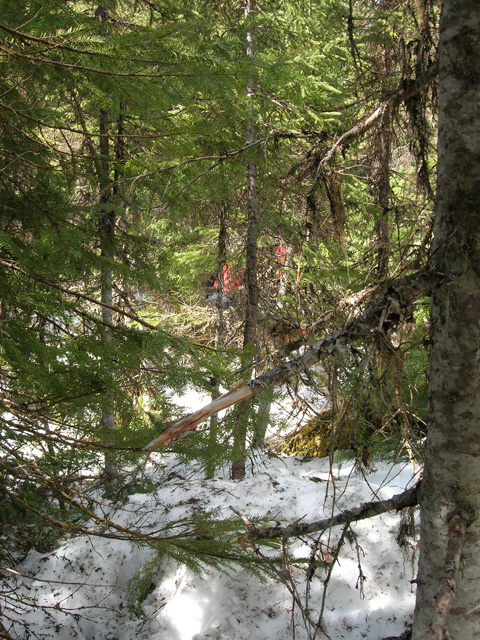
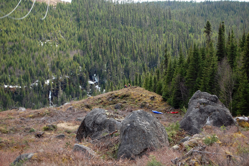
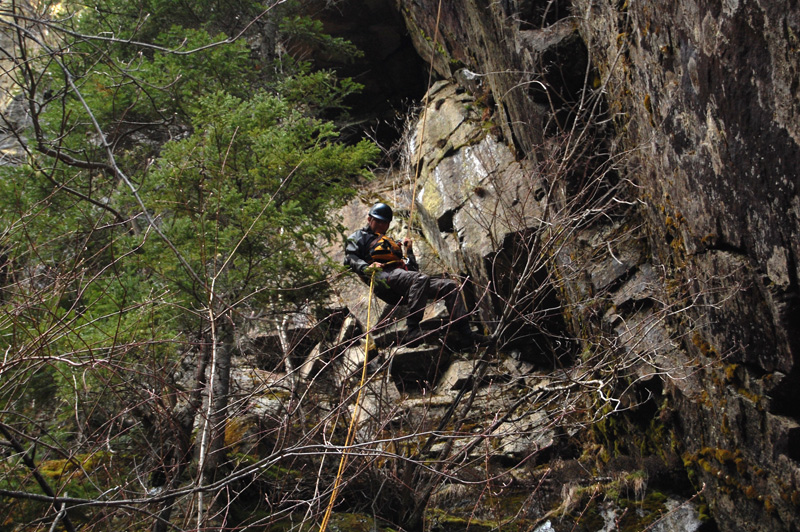
The portage around the entrance gorge is lengthy and through very thick forest. It is possible to follow the edge of the canyon. The better option is to walk north from the bridge along the road for a few hundred meters to a trail that will break right, heading for a power line that is about half way through the portage. Once at the power lines, head for the river at the downstream corner of the clear cut. Stay along the rim and drop in wherever you are comfortable doing so. This might take some time to sort out. You will need ropes to assist in descending to water level. Camping somewhere along this portage route (after portaging boats?) would be a good option for a 2 day trip.
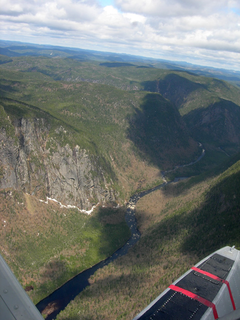
Once on the water, the action starts right away with a big rapids and ledges. Everything is easy to scout and most things can be portaged, however there are a few gorged sections where walking would be difficult or impossible. As you continue downstream the intensity of the rapids will increase and the river becomes continuous as it plunges through long stretches of steep boulder piles. Scout carefully. Just when you've had enough, the river will suddenly dump into a still lake and you have time to soak up the mind blowing scenery of the JCNW canyon.
At the end of the lake is a huge rapid called Landslide, seeming caused by the collapse of the canyon wall in to the river. This is the largest rapid on the run, not including the entrance gorge. It's big, steep, long and full of ugly rock. As of 2008 it's been run twice. Below Landslide is relatively easy whitewater until you reach the confluence with the Jacques Cartier. Continue on for another few kilometers to your car where food and drink are waiting!
The JCNO is a mission. I would recommend doing it, however be aware it's a big effort not without its share of hardship, and hard whitewater. The shuttle is excessive/expensive for the length of the river (you only run about 6 km of whitewater on the JCNW below the waterfall gorges), but the experience of passing through a place where very few people have been, or will be, makes this trip more than worthwhile. Hopefully this report will give you enough information to get started on a trip in there!
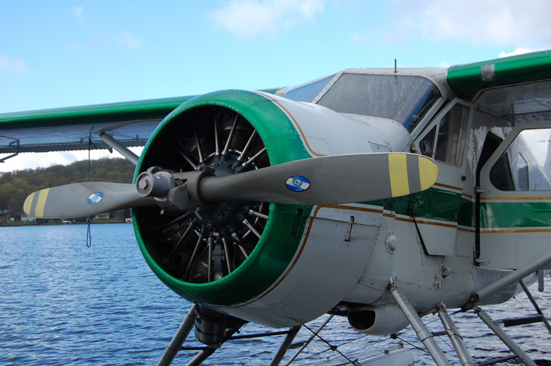 A classic shuttle rig.
 The confluence of the Jacques Cartier and the Jacques Cartier Nord Ouest. Photo Bob Butler.
 The waterfall on the upper river - no good today!
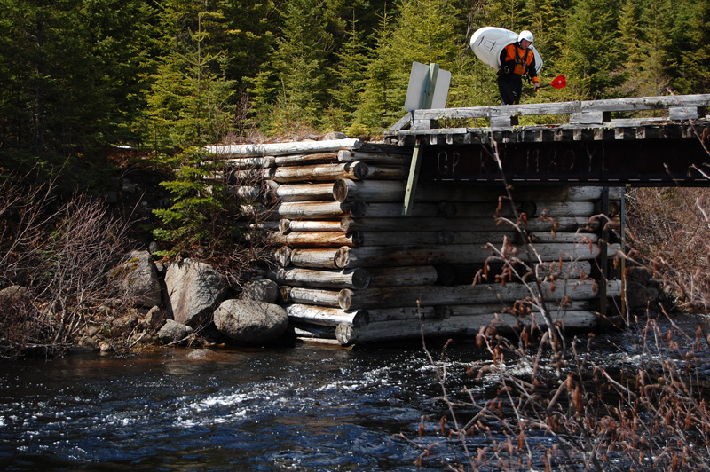 The bridge. Get out here.
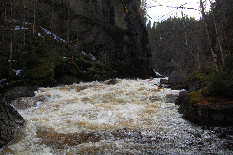
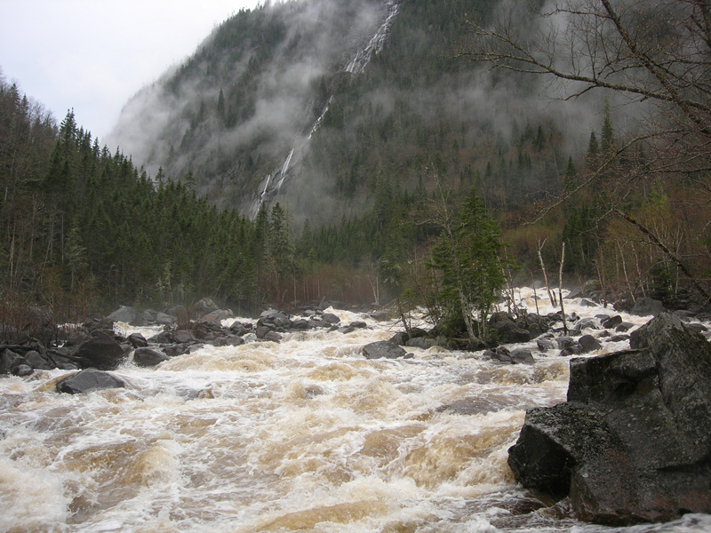
 Serious whitewater in the upper gorge.
 Thick, horrible forest on the portage.
 Taking a well deserved break mid way through the portage.
 River access.
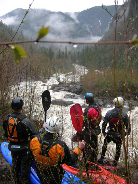
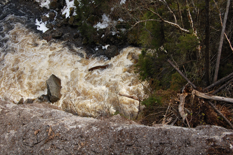 Peering down at one of the first big rapids of the trip.
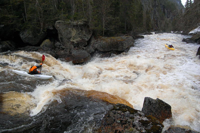
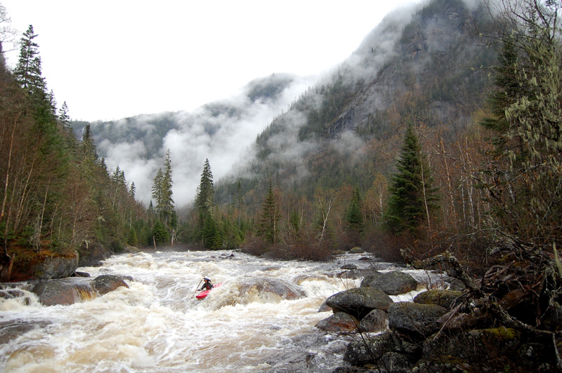
 A typical rapid.
 Probably the smallest rapid of the trip.
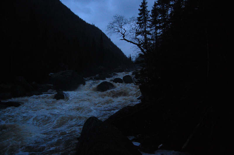 The lower river. Why is is so dark? Read the blog post to find out.
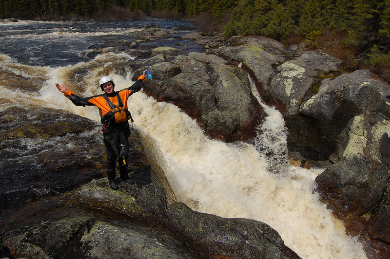
 Looking down at Landslide.
 Landslide, from the bottom.
 The last rapid of the gorge.
Updated May 11, 2009

