Vitals
- Locale: Whistler/Pemberton, British Columbia
- What It's Like: Fun river running in a small valley.
- Class: IV at medium levels, somewhat continuous. Tolerates high water very well, but becomes class V.
- Scouting/Portaging: Easy.
- Level: Visual.
- Time: 1-2 hours.
- When To Go: All summer - runnable over a wide range of levels.
- Info From: Many visits.
- Other Beta: None.
- Map: Click here for a map of the river zone.


Description
The Soo River is the oft forgotten and somewhat underrated third member of the Whistler Triple Crown, along with the Upper Cheak and the Callaghan. While it might not have the bang-for-your-buck factor of the other two Whistler mainstays because of its location on the far side of town, the classic section of the Soo is a good class IV (or more, depending on the level) river run with entertaining rapids from start to finish.
The Soo is essentially roadside along highway 99 half way between Whistler and Pemberton. The take out is at the obvious dirt pull out immediately upstream of the highway 99 bridge over the river - it is easy to find. The put in is more elusive - it is found approximately 3 km back towards Whistler just as the river bends away from the road. Look for a small dirt road between the highway and the river. There are two dirt roads - both work. From where you park, figure out a way to bash down to the river and put on.
Levels are visual only. The Soo has a particularly grey tinge to its glacial waters and can look full even when the water is medium or low if you're not familiar with the level. This river follows the general trend of high water in late May/June, dropping out to low water by mid/late August in a normal year. Interestingly the Soo tolerates high water well and can be run when other rivers in the area are blown out too high (the difficulty ramps up accordingly though). There is a useful 'stick' gauge just upstream of the takeout - see the photo below for more info.
The Soo from start to finish is great river running - boulder moves, fun rapids and chutes but no vertical drops. High flow turns the majority of the run into a continuous gauntlet of wavetrains and big holes. Everything is easy to bank scout or portage, and more aggressive boaters will have a blast boat scouting through all the whitewater. The two biggest rapids come back-to-back when a slope of jagged white blast rock shows up on river left. The second of the two is called Linda Lovelace. Below here things slowly ease off down to the takeout - if you're running at high flows there is a big hole lurking here that always causes moments of excitement.
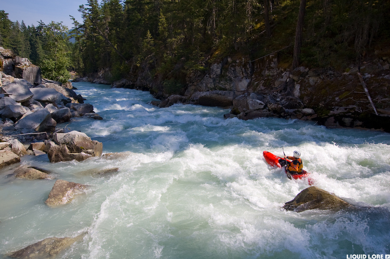 Typical Soo action.
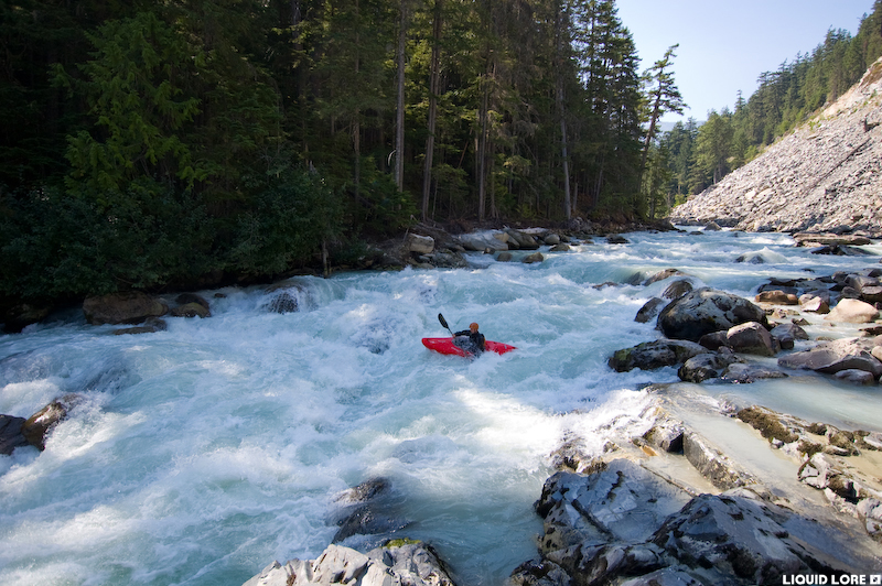 Linda Lovelace - the big one, medium-low flow.
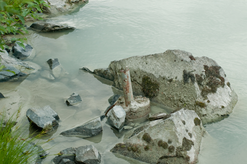 A useful gauge just upstream of the take out. Walk upstream to where the concrete highway barrier starts and go to the river - it's near the shore next to the rip rap on the bank. Water level with the top of the pole is high (goes much higher), water touching the concrete is medium to medium-low.
Updated June 25, 2015

